





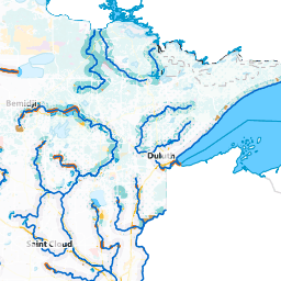
The Minnesota Department of Natural Resources has launched more than 60 new state water trail maps designed to help paddlers navigate waterways across the state and discover recommended routes for all ages and skill levels.
The updated maps highlight sections with fewer obstacles, maintained access points and a variety of trip options. Minnesota’s state water trail system spans more than 4,500 miles across 35 designated trails. River conditions can change quickly, so paddlers should check water levels before heading out.
The DNR also reminds outdoor enthusiasts that Minnesota’s new electronic licensing system goes live June 9.For more information on the new maps, recommended paddling routes and licensing updates, visit mndnr.gov.